E-walk - Hiking offline GPS
- 3.4
- Rating
- 100.00K
- Installs
- Free
- Price

 Analysis by App-foxy
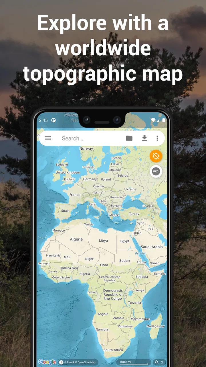
When I try a hiking app, I care less about a long feature list and more about what happens when I am standing at a trailhead with a weak signal, a half-charged phone, and no patience for complicated setup. E-walk is aimed at that exact kind of outdoor planning. It is a free Maps & Navigation app from Tim Autin, built around finding walks, recording them, and preparing maps for use away from a reliable connection.
That sounds straightforward, but navigation apps often become frustrating at the moment they matter most. A map may appear online but fail to load later, a route may be visible without being saved in the right way, or a recording may seem to stop when the phone changes its battery behavior. My experience with E-walk is that it can be useful for hikers who want a focused companion rather than a broad travel platform, but it rewards a little preparation. It is not the kind of app I would install five minutes before leaving and trust blindly on an unfamiliar route.
The important distinction is that offline preparation is a workflow, not a single button. You need to find the area, make sure the map content you need is available, and check that the saved material is accessible before you lose coverage. That habit makes a much bigger difference than simply having the app installed.
You May Also Like

 Blood Strike: 2.5 Anniversary
Blood Strike’s Loadouts Turn Every Drop Into a Tactical Gamble
A close look at Blood Strike’s custom loadouts: how fast access to signature weapons reshapes its battle royale rhythm, rewards preparation, and narrows the gap between fights.

 Pandora - Music & Podcasts
Pandora’s Music Is Easy to Start, but Harder to Recover
Pandora’s strength is its low-effort path from a seed to a station. Its weak spot is how much confidence it asks you to place in connection, setup, and quiet recovery.

 8 Ball Pool
 Is Built on Rivalries, Rematches, and Routine
A close look at the rivalries, rematches, shared routines, and unanswered safety questions that turn a quick pool match into a persistent mobile community.

 Samsung Music
’s Quiet Strength Is Playing What You Already Own
Its reach comes less from spectacle than from dependable access to a personal library. That simplicity is both the app’s strongest retention engine and its ceiling.

 AccuWeather: Weather Radar
AccuWeather Review: A Quick, Clear Forecast for Everyday Decisions
For everyday plans, the best forecast is the one you can understand quickly. AccuWeather makes rain timing, radar, and local conditions easy to act on, with a few trade-offs.

 Hill Climb Racing
Why Hill Climb Racing Still Turns Crashes Into One More Run
A tiny car, a bumpy hill and one more upgrade: Hill Climb Racing keeps resurfacing because its simple chaos makes every near-miss feel personal.
More From Our News Desk



Getting past the first points of friction
I find the first few minutes with a hiking app tell me whether its routine will fit a real walk, not just look clear at home. This section focuses on small checks that make offline preparation easier to trust, especially when I am learning where map browsing ends and recording begins. A little practice on familiar ground gives me a better starting point for making the app part of a repeatable hiking habit.
Finding a useful starting point
The first challenge is deciding what you want E-walk to do on a particular outing. If I am browsing for a new hike, I begin with the map rather than immediately starting a recording. I look at the wider area first, then narrow my attention to the trail or walking route that seems realistic for the day. This matters because a map that is useful for discovering possibilities is not automatically ready for offline use.
I also avoid planning only around the exact line I expect to follow. A small detour, an unexpected junction, or a wrong turn can take me outside a narrow saved area. For a short local walk, that may not matter. For a longer outing, I prefer leaving enough map coverage around the route to make decisions without constantly worrying about the edge of the downloaded material.
One practical mistake is treating the app like a search engine for guaranteed trail conditions. E-walk can help me inspect and record a route, but it does not replace common sense about weather, closures, terrain, daylight, or local guidance. I use it to support a plan, not to decide whether a route is safe by itself.
Checking the map before leaving
Offline maps are most valuable when tested before the trip. After preparing an area, I temporarily behave as if the phone has no connection: I move around the relevant map, inspect the route, and check whether the level of detail I expect is actually available. If the map looks blank or incomplete during this test, I fix that at home instead of discovering the problem on a hillside.
This check also reveals a subtle trade-off. A broad area gives me more flexibility, while a more detailed view can be more useful at confusing trail junctions. I do not assume that saving one view automatically gives me every level of detail I might want later. My safer routine is to prepare the route and the surrounding decision points, then verify them in the offline situation.
For a normal day hike, I would prepare the map while connected to Wi-Fi, keep the phone charged, and carry a simple written note of the trail name or intended direction. That is not because E-walk is unusable; it is because navigation is more dependable when one failure does not remove every reference.
Recording without losing the outing
Recording a hike is different from browsing a map. Before I start walking, I make sure I have selected the recording action deliberately and can recognize that it is active. I do not put the phone away immediately after tapping a button. I watch for a moment, move a short distance, and confirm that the track is behaving as expected.
That small pause prevents a surprisingly common problem: completing a walk and discovering that only the first few minutes were captured. It is also useful to check the recording after stopping, before leaving the trailhead. If the route matters to me, I treat saving it as part of finishing the hike rather than something I will remember later at home.
A recorded track is especially helpful for reviewing where I actually went, not just where I intended to go. I can use it to spot a missed turn, compare a planned route with reality, or remember a pleasant section for another visit. However, I do not confuse a recorded line with a complete trip report. It may show movement, but it does not automatically explain trail conditions, private land, hazards, or whether a path is suitable for someone else.
What to check when offline access seems broken
If the map works at home but not outside, I first check the simple explanation: was the relevant area genuinely prepared for offline use, or was I only viewing it online? I then check whether I am looking at the same location and map detail that I tested earlier. A saved route and a saved map area are related, but they are not the same thing in my planning routine.
If the app appears stuck while preparing content, I return to a stable connection and retry with a smaller, clearly defined area. I avoid repeatedly starting several downloads or preparations at once. A clean, deliberate attempt is easier to understand than a collection of partial attempts. I also leave enough free phone storage for map material and avoid doing the preparation while the device is already struggling with other heavy tasks.
When a map is visible but difficult to read, I adjust the view before assuming the app has failed. Outdoor maps can contain a lot of information, and the most useful detail may only become clear at a closer level. I prepare both the broad route context and the junctions where I expect to make decisions.
Building a reliable hiking routine around E-walk
Once I know how the basic steps behave, I can spend less attention on the phone and more on the route. Here I look at how to make preparation, recording, and post-walk review work together, while keeping sensible backups for situations the app cannot resolve. That routine matters most when a hike is unfamiliar or coverage is patchy, so the next section turns from first-use friction to consistency.
A practical setup sequence
My preferred setup is simple. I install the app, open it while connected, and spend a few minutes learning where route discovery, map preparation, and recording fit into the interface. I then choose a familiar local walk for the first real test. A known route is valuable because I can judge the app without also trying to solve an unfamiliar navigation problem.
For that first test, I prepare the map, start a recording, walk a short loop, and stop the recording before checking the result. I repeat the process with the phone briefly disconnected if possible. This gives me a realistic answer to the questions that matter: can I find the prepared area, can I follow the map comfortably, and can I recover if I make a small mistake?
I would not begin with a remote, all-day hike. The app is free to install, but the time spent learning its offline workflow is still an investment. A short test costs little and can expose problems with storage, battery habits, map preparation, or simple misunderstanding of the controls.
Recovering when a route goes wrong
Suppose I notice that the recorded line has stopped or that I have wandered away from the intended path. I do not immediately delete anything and start over. First, I check whether the recording is still active and whether the phone has changed screens or entered a restrictive battery state. If the track has genuinely stopped, I save what exists if possible, make a note of the interruption, and begin a new segment rather than pretending the gap is part of the route.
This segmented approach is more useful than losing the entire day because of one interruption. Later, I can understand where the break occurred and avoid making the same mistake. It also keeps me calm: the app is a tool for documenting the walk, not a reason to rush or take an unsafe shortcut back to the planned line.
If offline navigation becomes confusing, I widen the view and look for recognizable landmarks, trail junctions, or the direction from which I came. I do not follow a line mechanically when the terrain disagrees with it. A map can be outdated, a path can be poorly marked, and a route can cross ground that is unsuitable in current conditions. In those moments, turning back or using a second navigation reference is the sensible choice.
When the phone is the real problem
Not every interruption points to E-walk. GPS performance can vary with the phone, the surrounding landscape, and the way the device is being carried. Dense trees, steep terrain, buildings, and poor sky visibility can all make location updates less convincing. If the position jumps, I wait in a safe place and compare the movement with what I can see around me instead of immediately assuming the map is wrong.
Battery behavior is another major factor. A long recording session with the screen active can drain a phone quickly, while aggressive power-saving behavior may interfere with background activity. I start with a full charge, dim the display when practical, and carry a power bank for trips where returning safely depends on the phone. I also keep a physical backup such as a paper map, especially when the route is remote or conditions may change.
Storage can cause its own friction. Offline map material and recorded tracks need room, so I check the device before preparing a large outing. If the phone is nearly full, clearing unnecessary files is more sensible than repeatedly retrying the same operation and wondering why it behaves inconsistently.
Permissions and system settings deserve a calm check as well. If location access has been restricted, or if the operating system is limiting the app in the background, recording may not behave as expected. The exact menus vary by phone, but the general fix is to review the app’s location and battery settings and then test them on a short walk. I would rather verify this near home than troubleshoot it beside an unfamiliar trail.
How it compares with familiar alternatives
E-walk makes the most sense to me when I want a hiking-oriented map and a direct way to record a route without turning the experience into a social feed. Compared with a general mapping app, its appeal is the emphasis on walks and offline preparation. A general map may be better for driving directions, shops, public transport, or finding an address, but it may not fit the rhythm of planning and recording a hike as neatly.
Compared with a dedicated route-sharing service, E-walk feels more practical for personal navigation than for discovering a large community of heavily reviewed activities. If I wanted extensive user commentary, polished route recommendations, or a strong social layer, I would look at alternatives designed around those priorities. If I mainly want to inspect a walk, prepare map access, and keep a record of my own movement, E-walk is a more focused choice.
The trade-off is that focus. I would not choose it as my only tool for complex expedition planning, detailed safety information, or situations where live services and broad travel features are essential. Its value is strongest when I take responsibility for preparing the map and checking the route rather than expecting the app to handle every part of an outdoor trip.
Who should use it and who should skip it
I can recommend E-walk to casual hikers, walkers exploring nearby countryside, and people who want a simple record of where they have been. It is also a good fit for anyone who regularly enters areas with unreliable mobile coverage and is willing to prepare maps before leaving. The free price makes it easy to test without committing money at the start, although optional in-app purchases range from around five dollars to around thirty dollars per item, so I would review any purchase screen carefully before confirming anything.
I would be more cautious recommending it to someone who wants a completely automatic experience. If you dislike checking offline content, monitoring battery behavior, or learning how recording works, the setup may feel like unnecessary work. Likewise, a person who needs highly detailed route intelligence, live traffic, extensive community reports, or a full outdoor safety system may be happier with a more specialized alternative.
The Everyone age rating makes it broadly approachable, but age suitability does not remove the need for adult judgment outdoors. A young user should still have an appropriate route, supervision when needed, and a backup plan. The app can support navigation; it cannot assess a child’s ability to handle weather, distance, terrain, or an unexpected detour.
What the current release tells me
E-walk has been available since late July 2015, and the current version is 1.6.4. It supports devices running Android 6.0 or later. That makes compatibility worth checking before installation, particularly on an older phone that may also have limited storage or battery capacity.
The app has passed the threshold of one hundred thousand installs, while its average rating sits at 3.4 from roughly eight hundred ratings. I read that as a sign of a useful but not universally smooth experience: enough people are using it for the concept to prove valuable, but the middling score suggests that setup, reliability, or expectations may vary between users and devices. The smaller body of written feedback—around two dozen reviews—also makes my own short local test more useful than relying on a single impression.
In everyday use, I would plan a Saturday walk this way: while connected at home, I find the route, prepare a generous surrounding map area, and inspect the confusing turns at a useful detail level. Before leaving, I confirm the map can be viewed without relying on the network. At the trailhead, I start a recording, walk a short distance, and verify that it is progressing. During the hike, I keep a backup reference and avoid draining the phone unnecessarily. At the end, I stop and check the recorded result before packing away the device.
That routine may sound more deliberate than opening a standard map and following a live blue dot, but it is exactly where E-walk earns its place. Offline navigation is not magic; it is preparation that pays off when coverage disappears. The app gives me a useful framework for that preparation, provided I do not skip the checks.
My final view is favorable but measured. E-walk is best for hikers who want offline map preparation and personal route recording, and who are comfortable taking an active role in setup. I would use it for local walks, planned day hikes, and exploring areas where a connection cannot be assumed. I would pair it with a backup on remote routes and choose another app when live travel services, rich community information, or more advanced expedition planning matter more than a focused hiking workflow.
FAQs for E-walk - Hiking offline GPS
01What is E-walk – Hiking offline GPS used for?
E-walk – Hiking offline GPS is designed for hikers, walkers, cyclists, and outdoor travelers who need navigation away from reliable mobile coverage. It lets you view maps, plan routes, record tracks, save points of interest, and follow your position using your phone’s GPS. The app is especially useful for exploring trails, parks, rural areas, and unfamiliar destinations without depending entirely on an internet connection.
02Does E-walk work without an internet connection?
Yes, E-walk can be used offline when the necessary map data has been downloaded or prepared in advance. Before starting a hike, you should open the area while connected to the internet and make sure the required maps and route information are available on your device. GPS positioning itself does not require mobile data, but downloading maps, searching online information, and some map services may need an internet connection.
03Can I record and save my hiking routes with E-walk?
The app supports outdoor route tracking, allowing you to record your movement while hiking or traveling. Depending on the selected tools and map source, you can monitor your position, review the path you have taken, and save useful locations or tracks for later reference. It is still advisable to test the recording features before a long trip and keep your phone charged throughout the activity.
04Is E-walk suitable for serious hiking and navigation?
E-walk can be a practical navigation companion for day hikes, walking trips, sightseeing, and many backcountry activities, particularly when offline maps are prepared beforehand. However, it should not be treated as your only safety resource in remote terrain. Trail information may be incomplete or outdated, GPS accuracy can vary, and weather or environmental conditions can affect your plans. Carry a backup map, power bank, and basic emergency equipment.
05Does E-walk require payment or offer in-app purchases?
The availability of free and premium features may depend on the version of E-walk, your platform, and the map services you choose to use. Some functions or external map sources can involve limitations, advertising, subscriptions, or in-app purchases. Before downloading, check the current Google Play or App Store listing for pricing, supported features, and any purchase requirements. Also review whether offline map downloads use significant storage space.
Pros
- Works offline with downloaded maps and GPS tracking.
- Useful route recording for hikes
- walks
- and outdoor trips.
- Supports GPX files for importing and exporting routes.
- Displays detailed map data for planning unfamiliar trails.
- Can help reduce mobile data use during outdoor adventures.
Cons
- Offline maps must be prepared before entering areas without coverage.
- Some advanced mapping features may require in-app purchases.
- Battery usage can increase during long GPS tracking sessions.
- Map coverage and trail details vary by country and region.
- The interface may feel complex for casual users and beginners.

E-walk - Hiking offline GPS
Gallery